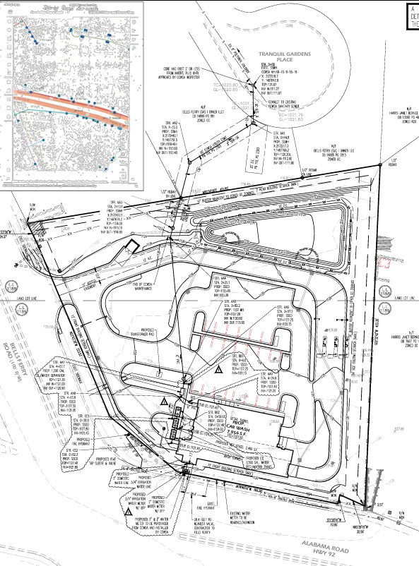
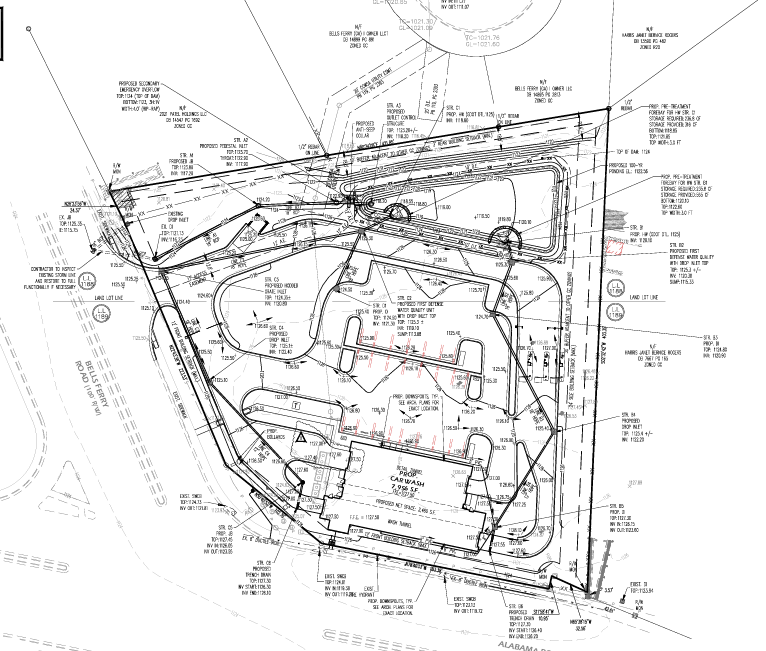
Project Overview
Prepared right-of-way and utility survey drawings for infrastructure planning and engineering coordination.
Scope of Work
• ROW limits drafting
• Utility mapping
• Easement depiction
• Annotation and labeling
Tools Used
AutoCAD | Civil 3D
Deliverables
Survey-ready ROW and utility CAD drawings.