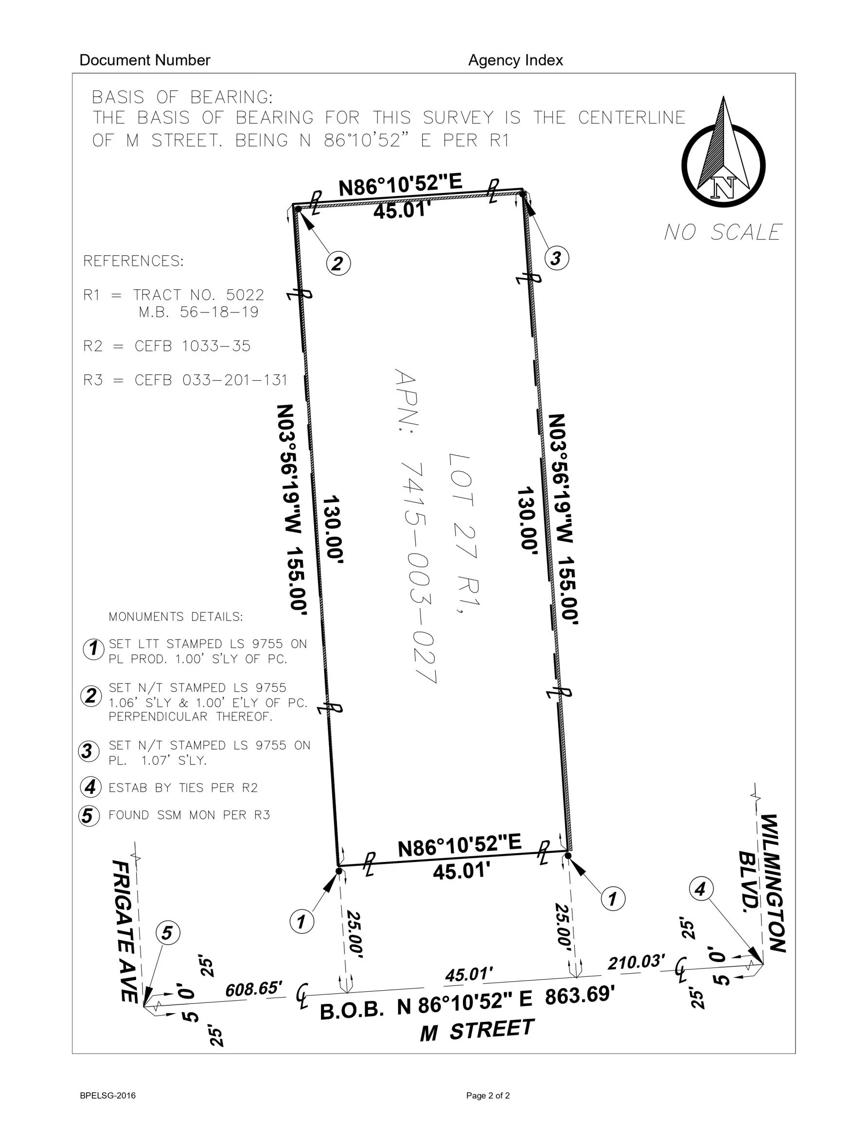
Project Overview
Converted LiDAR point cloud data into accurate 2D CAD drawings for engineering and planning use.
Scope of Work
• Point cloud processing
• Feature extraction
• Surface and linework drafting
• Layered CAD output
Tools Used
AutoCAD Recap | Civil 3D | Carlson
Deliverables
Structured CAD drawings derived from point cloud data.